A truck GPS that knows what a truck is
Navitruck routes trucks and HGVs around low bridges, weight, width and length limits, hazmat bans and tunnel categories — and warns you before each one, even when the app is running in the background. Offline 3D maps for every region are included.


3-day free trial on the web · 7 days in the app · Cancel anytime
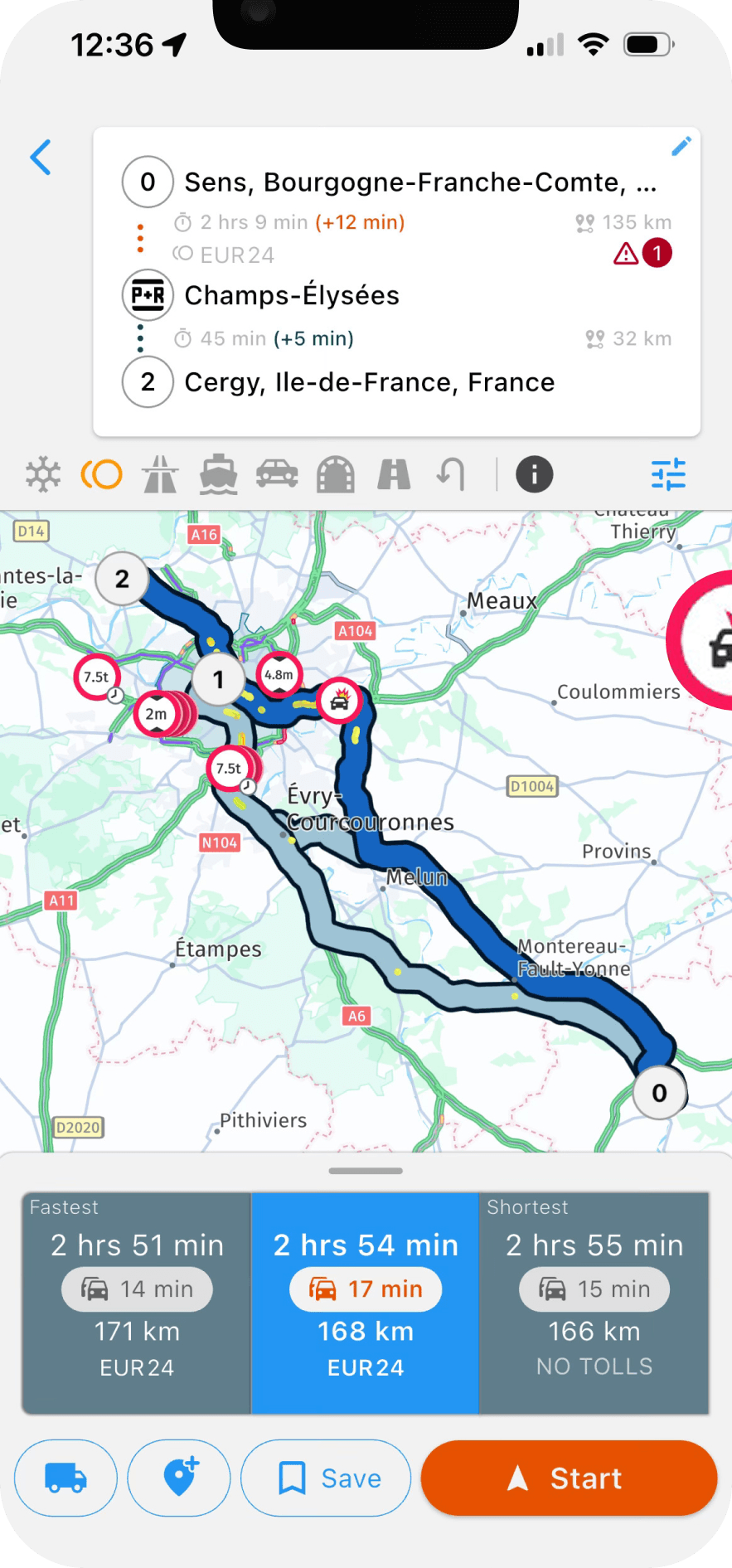
Why a car sat nav sends trucks under bridges
Consumer navigation apps find the fastest route for a car. They do not know how tall, heavy, wide or long your vehicle is, and they do not carry the restriction data that would let them use that information. The result is familiar to any HGV driver: a route down a lane with a 7.5-tonne limit, or under a railway bridge lower than the trailer.
A truck GPS app starts from a vehicle profile. You enter height, width, length, axles, gross weight, hazmat class and tunnel category once, and every route and alert is calculated for that configuration. Navitruck stores multiple profiles, so a driver who switches between a rigid and an artic switches profile rather than re-entering numbers.
Restriction avoidance built into the route
Every route Navitruck calculates already avoids the restrictions that apply to your profile. That covers low bridges and underpasses, posted weight limits, width and length limits, roads where trucks are banned, hazmat exclusion zones and tunnels whose category forbids your load. When traffic or a closure triggers a reroute, the new route is held to the same rules.
- Height, weight, width and length limits
- Hazmat bans and ADR tunnel categories (B, C, D, E)
- No-truck roads and residential bans
- Multi-stop routes with toll costs shown before you commit
An alert before every restriction — even in the background
Most bridge strikes do not happen on the planned route. They happen on a detour, while looking for a parking bay, or on a short local hop where setting a destination felt unnecessary. Navitruck keeps checking the road ahead against your vehicle profile as long as the app is running, foreground or background, and warns you in time to stop or turn — whether or not a route is active.
Offline 3D maps, all regions included
Signal drops in exactly the places where restrictions are hardest to spot. Navitruck's maps, including the restriction data, download for offline use, so routing, search and alerts keep working with no data connection. Every region is included in Premium; there is no per-country add-on. Live traffic and speed camera updates resume when you are back online.
Made for the vehicle you actually drive
Lane guidance at complex junctions, speed camera warnings and truck-specific points of interest — parking, fuel, weigh stations — round out the app. The same engine serves trucks and HGVs, buses and coaches, RVs and caravans, and owner-operators running a single unit. One Premium subscription covers iOS and Android.
Common questions
Does Navitruck work for HGVs in Europe and trucks in North America?
Yes. Navitruck covers 100+ countries with truck-specific map data, including height, weight, width and length restrictions and ADR tunnel categories. The same vehicle profile drives routing and alerts wherever you are.
Do I need a data connection to navigate?
No. Download the regions you drive and routing, search and restriction alerts work offline. Live traffic and speed camera updates need a connection and resume automatically when you have one.
Will it warn me if I am not following a route?
Yes. As long as Navitruck is running, in the foreground or in the background, it compares the road ahead with your vehicle profile and alerts you before a low bridge, weight limit or restricted road, even with no destination set.
How much does it cost?
Navitruck Premium is $8 per month or $69 per year, and you can cancel anytime. Web subscriptions start with a 3-day free trial ($0 due today); subscribing inside the app from the App Store or Google Play gives a 7-day trial.
Stop guessing at the next bridge
Set your vehicle profile once and let every route and alert be calculated for it.
3-day free trial on the web · 7 days in the app · Cancel anytime
More about Navitruck
- Low bridge GPSHeight-based routing and an alert before every low bridge.
- Hazmat & tunnel routingADR-aware routes that respect tunnel categories.
- Offline truck maps3D maps for every region, downloadable at no extra cost.
- RV & caravan GPSNavigation that knows your motorhome's height and weight.
- BlogGuides on vehicle profiles, bridge strikes and background alerts.