For a commercial driver the road is a workplace, and one of its most expensive hazards is a bridge that is lower than the vehicle. A missed sign, an outdated map or a car sat nav that does not know what a truck is can end with the roof of a trailer peeled open, a closed road, a fine, and a very long conversation with the insurer.
This article explains what a truck-specific navigation system actually does differently, and how Navitruck approaches the problem.
Why a car GPS is not enough
Consumer navigation apps find the fastest route for a car. They do not know your height, weight, width or length, and they do not carry the restriction data that would let them use it. That is why a car app will happily route a 4.2 m trailer under a 3.6 m railway bridge, or down a lane with a 7.5 t limit.
A truck router works from a different set of inputs:
- Vehicle dimensions. Height, width, length, axles and gross weight decide which bridges, tunnels, junctions and roads are physically and legally usable.
- Load type. Hazmat class and tunnel category rule out tunnels and areas where dangerous goods are banned.
- Road restrictions. No-truck zones, weight limits, width limits and residential bans are avoided rather than discovered on arrival.
- Live conditions. Traffic and closures trigger rerouting — with the same restrictions still applied to the new route.
How Navitruck approaches it
1. An alert before every restriction — even in the background
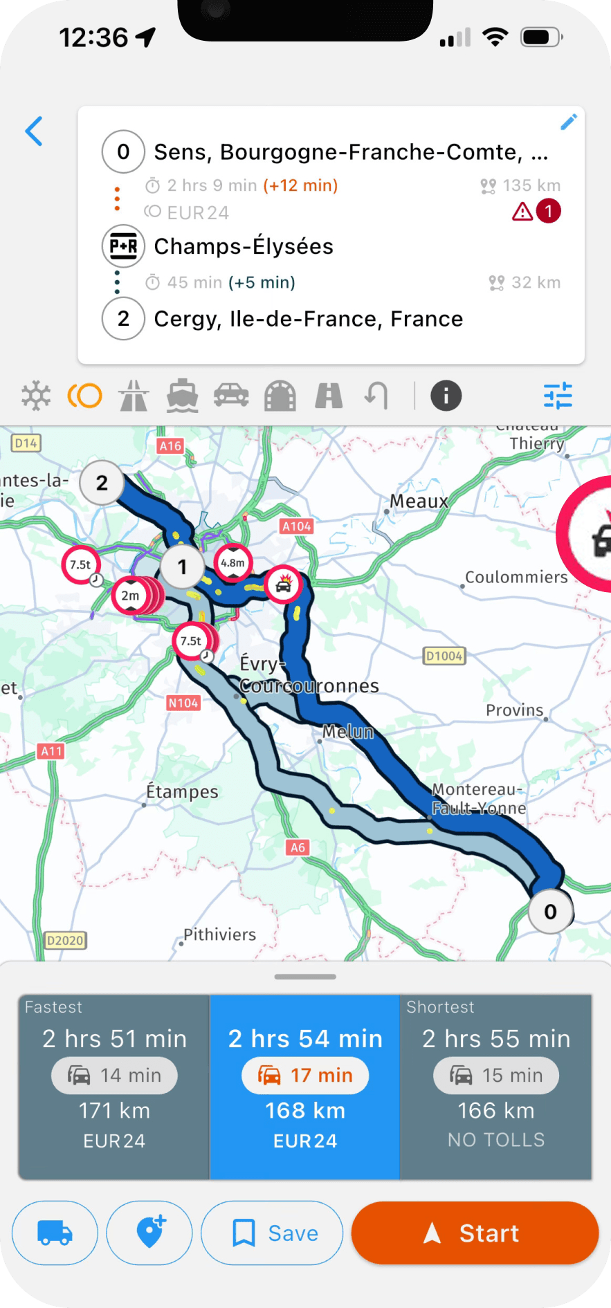
Navitruck does not only plan a safe route. It watches the road ahead against your vehicle profile and warns you before a low bridge, weight limit or restricted road, whether or not a route is active and even when the app is running in the background. That covers the detours, parking searches and short hops where most strikes happen.
2. Offline 3D maps, all regions
Drivers regularly lose signal in the places where restrictions are hardest to spot. Navitruck's maps, including the restriction data, download for offline use, so routing and alerts do not stop when coverage does. Every region is included; there is no per-country add-on.
3. A profile for each vehicle
You enter height, width, length, axles, gross weight, hazmat class and tunnel category once per vehicle, and every route and alert is calculated for that configuration. Switch profiles when you switch vehicles. If you want the detail, read what every truck driver should set in their vehicle profile.
4. Less stress at the wheel
Beyond restriction avoidance, the app is built for a large vehicle: lane guidance at complex junctions, speed camera warnings, truck-specific points of interest such as parking, fuel and weigh stations, and multi-stop routing with toll costs shown before you commit to the route.
The bottom line
A bridge strike is never just damage to one vehicle. It closes roads, stops trains, delays every load behind it and puts people at risk. A navigation system that knows what a truck is, works without signal, and keeps watching when you are off-route removes most of the ways that day begins.